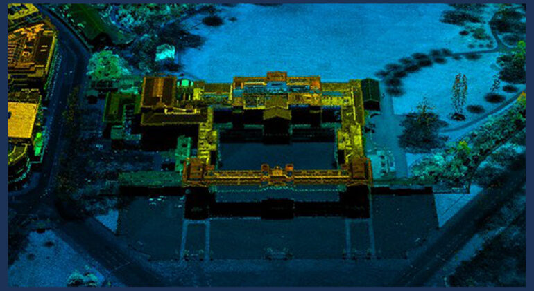
When beginning any major drainage or sewer project, the first step is to survey the network. With smaller repair jobs, feeding CCTV into the lines is a simple and effective way of understanding and assessing the condition and any work that needs to be done. In most cases, we livestream CCTV footage to our servers for further analysis and archiving.
When it comes to bigger projects including drainage systems with a large footprint, traditional surveying methods are very time-consuming, averaging one measurement taken per 30 seconds. In a complex system, that can mean CCTV methods are both inefficient and prohibitively expensive.
With the advent of advanced technologies, new methods have evolved to help eliminate these hugely time-consuming tasks. Of these new developments, the most effective large-scale surveying method is Point Cloud Laser Scanning.
Point cloud laser scanning has been around for over 20 years and was mainly used in the mining industry to measure and calculate the size of mine shafts or spoil piles. Nowadays, it is increasingly used in the built environment to capture precise layouts of land, buildings, structures and the MEP services within them.
A point cloud scan takes 976,000 points/second, making it one of the fastest methods of measuring areas, and records a wide range of information making it also one of the most accurate.
What Is A Point Cloud?
A point cloud is a set of 3D data points captured by a laser scanner — it is the output of the 3D laser scanning process. Point clouds are obtained with 3D laser scanning technologies like LiDAR (Light Detection and Ranging), structured light scanning, or photogrammetry.
To capture every visible detail of the site, the laser scanner must be positioned around the site from varying viewpoints. Trained technicians complete this process to ensure proper collection of data and correct scanning methods. Millions of data points are captured and processed into a point cloud, creating an accurate site data set.
2D and 3D CAD or Revit drawings are then produced from the information captured. The system is also capable of producing 3D 360º photographic walkthroughs of the site, allowing a remote view of site areas, assets and services. These 3D datasets offer an extremely accurate, scale representation of site infrastructure, such as drainage systems and can be used to identify existing or potential issues in the network.

The Benefits Of Point Cloud Laser Scanning
- Highly accurate measurements allow for the creation of scale drawings and models
- Single survey capturing multiple data means less need for repeat surveys
- Eliminates need for manual surveying in confined spaces, enhancing worker safety
- Creation of 360-degree visual walkthroughs of sites, which can be used to either gather additional information or take additional measurements
- Allows operatives to view potential problems/risks prior to undertaking repairs
- Ability to scan in low light environments to capture tunnels/undercroft areas where other forms of survey may not be suitable.
By integrating accurate measurement data and visual imagery 3D laser scanning provides designers, engineers and project managers with the information they need to deliver cost, time and safety efficiencies throughout their project delivery.
Contact Us About Our Range of Survey Services
Call 01274 050137 • Email info@mrms.co.uk

